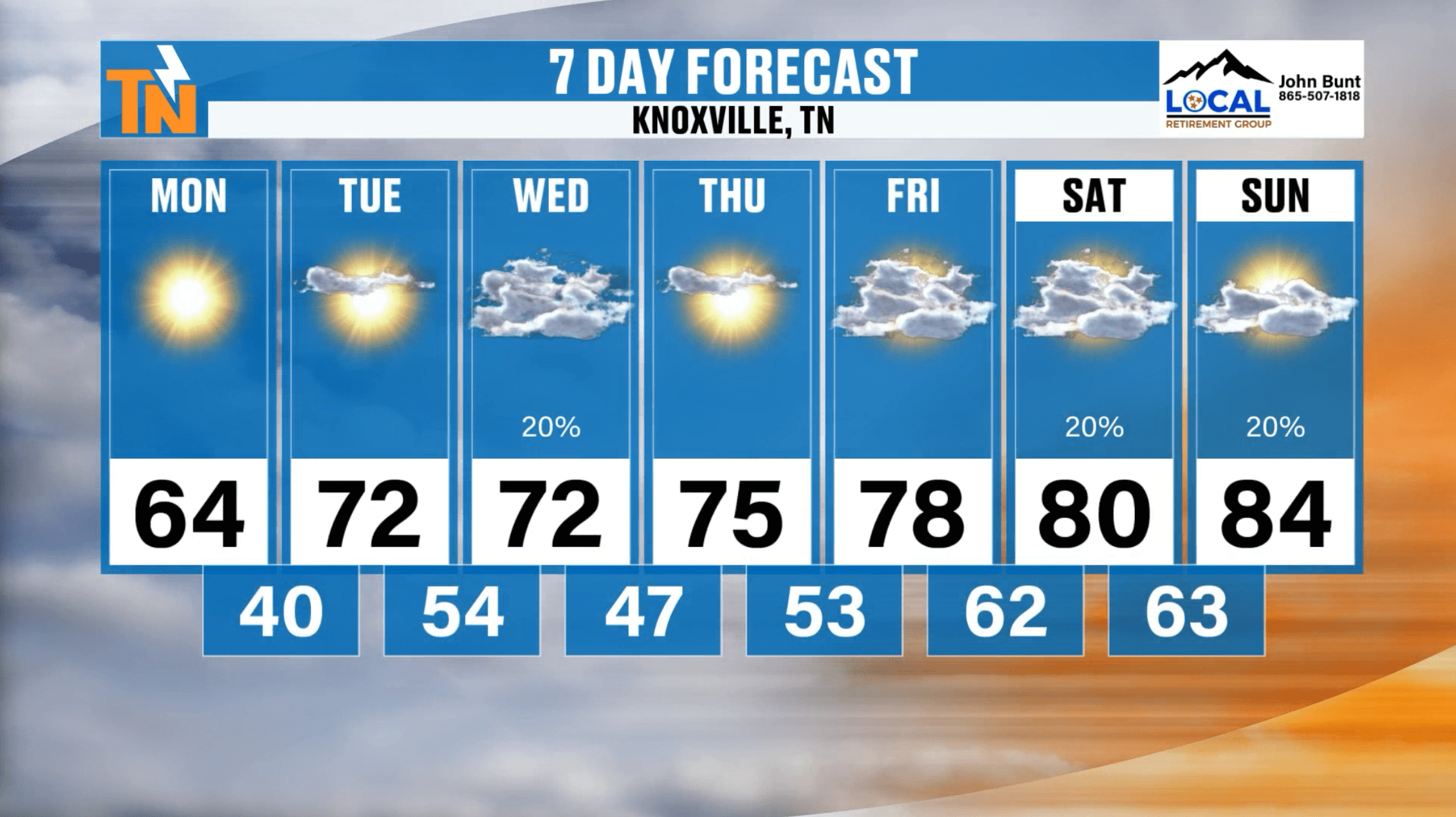
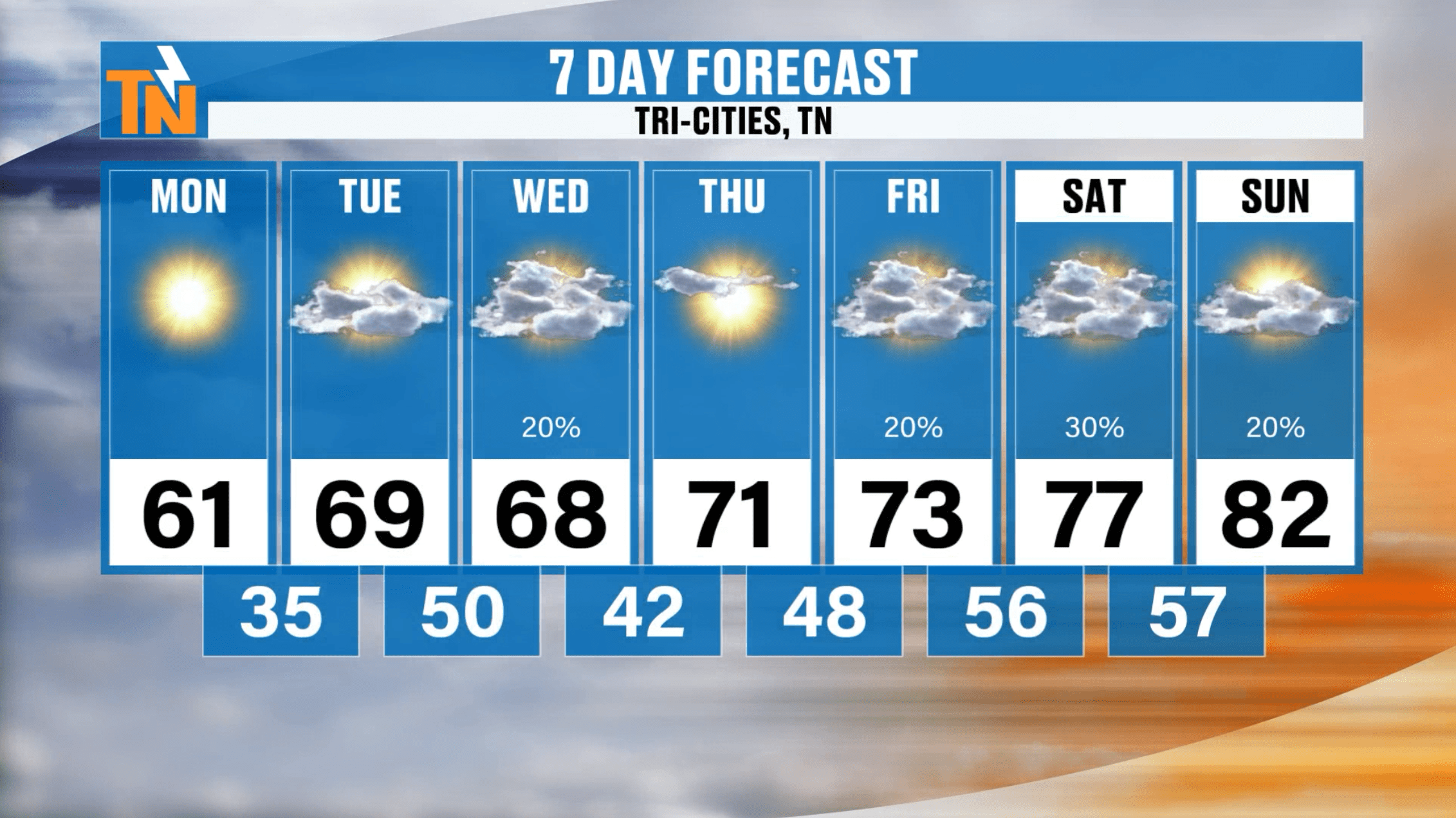
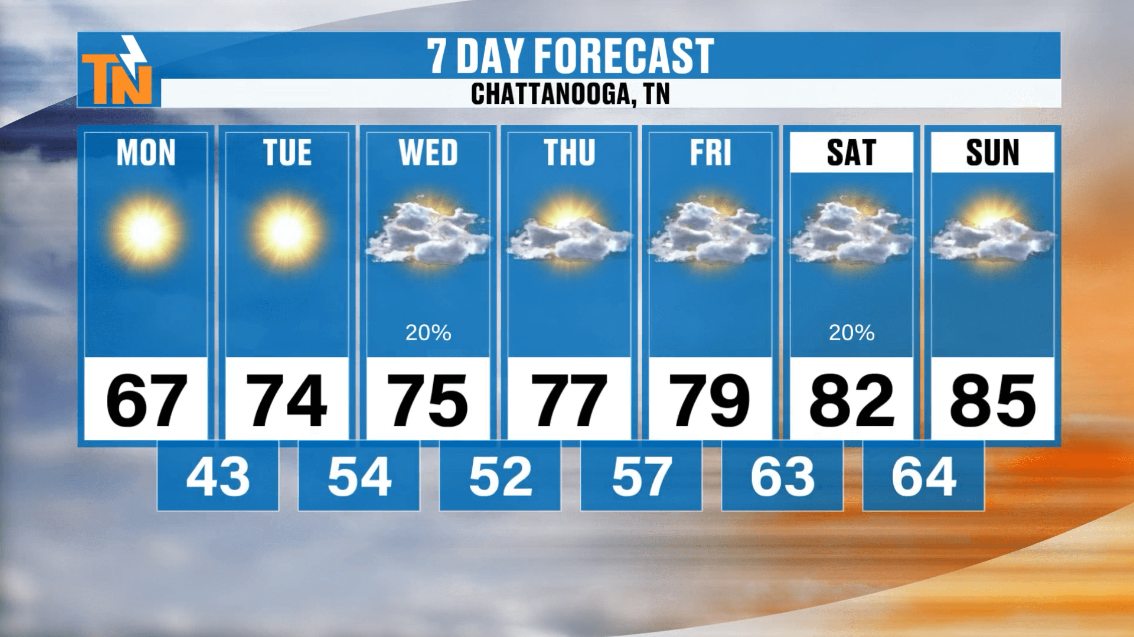
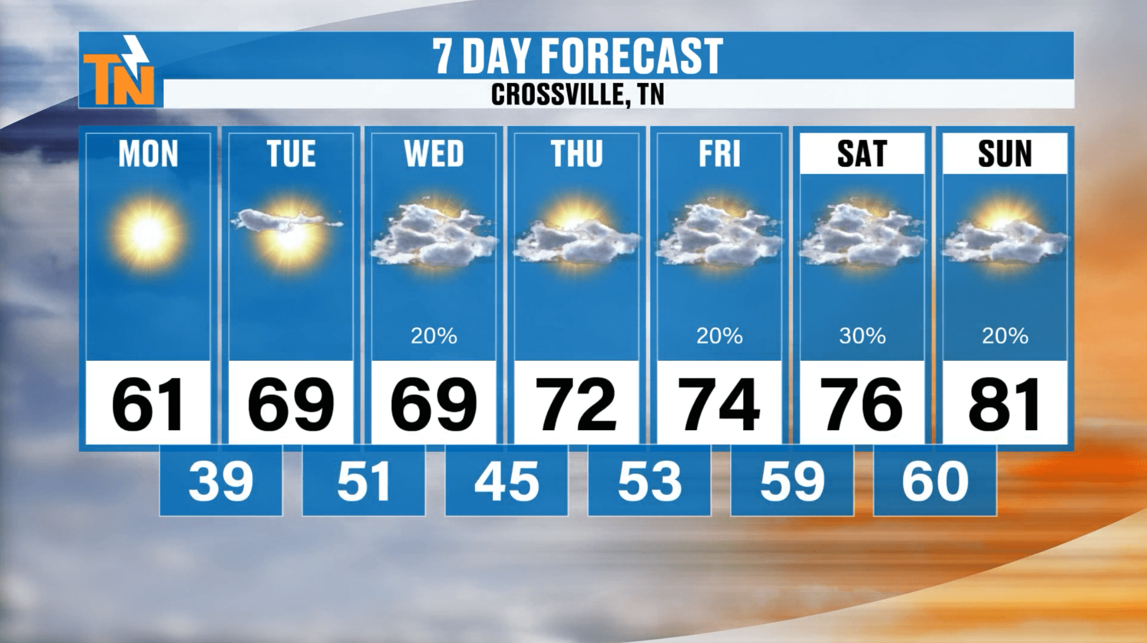
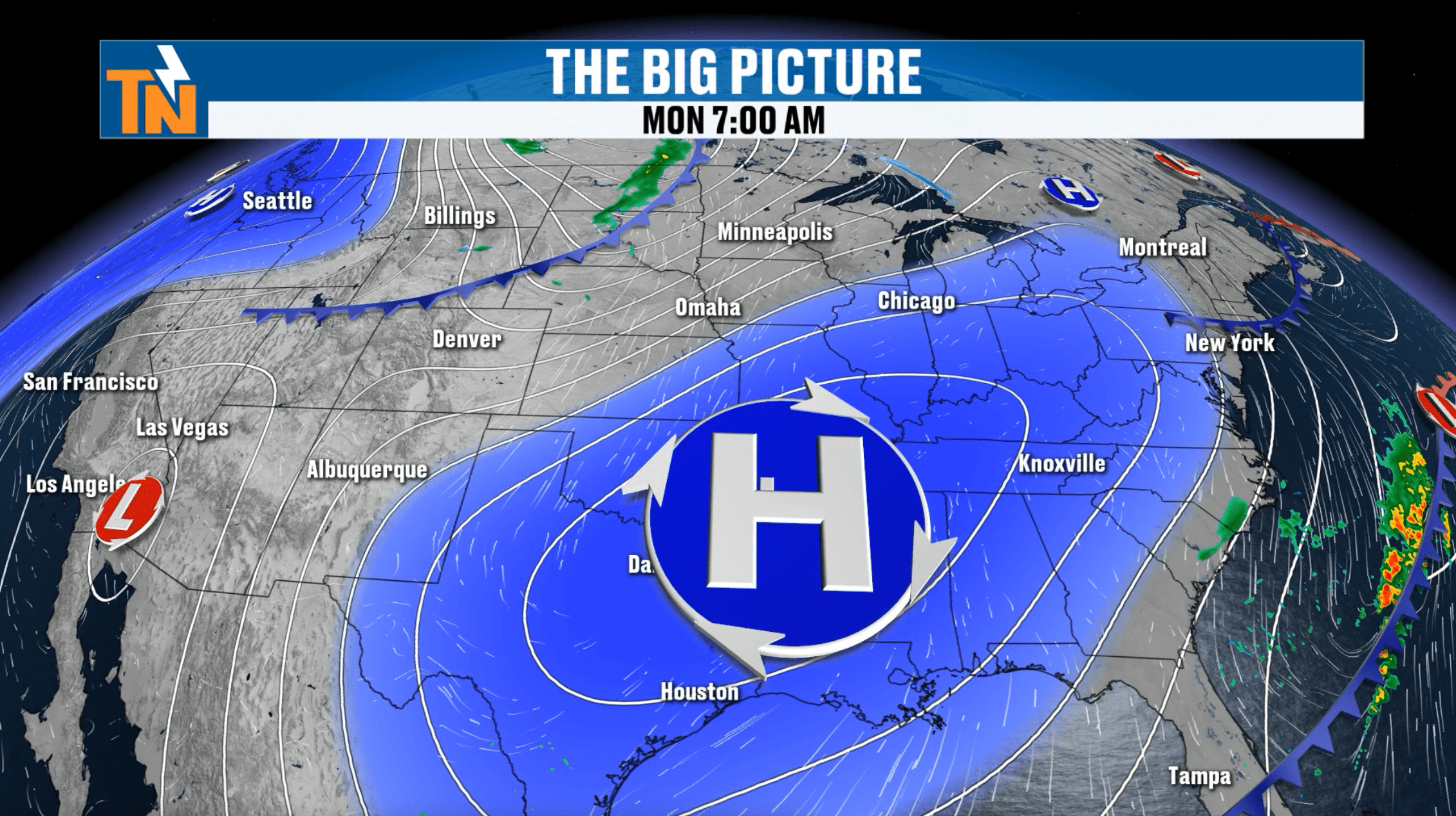
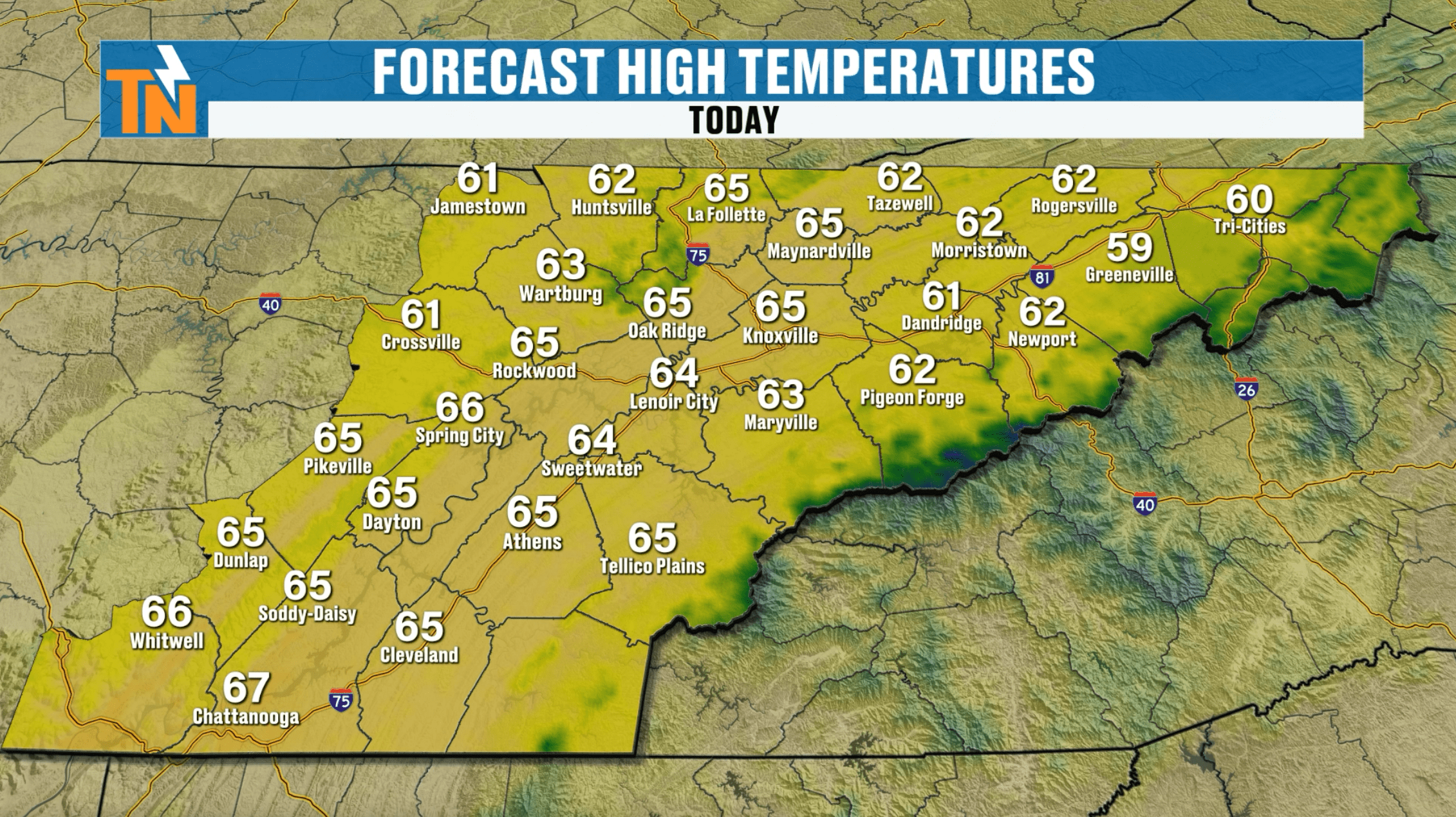
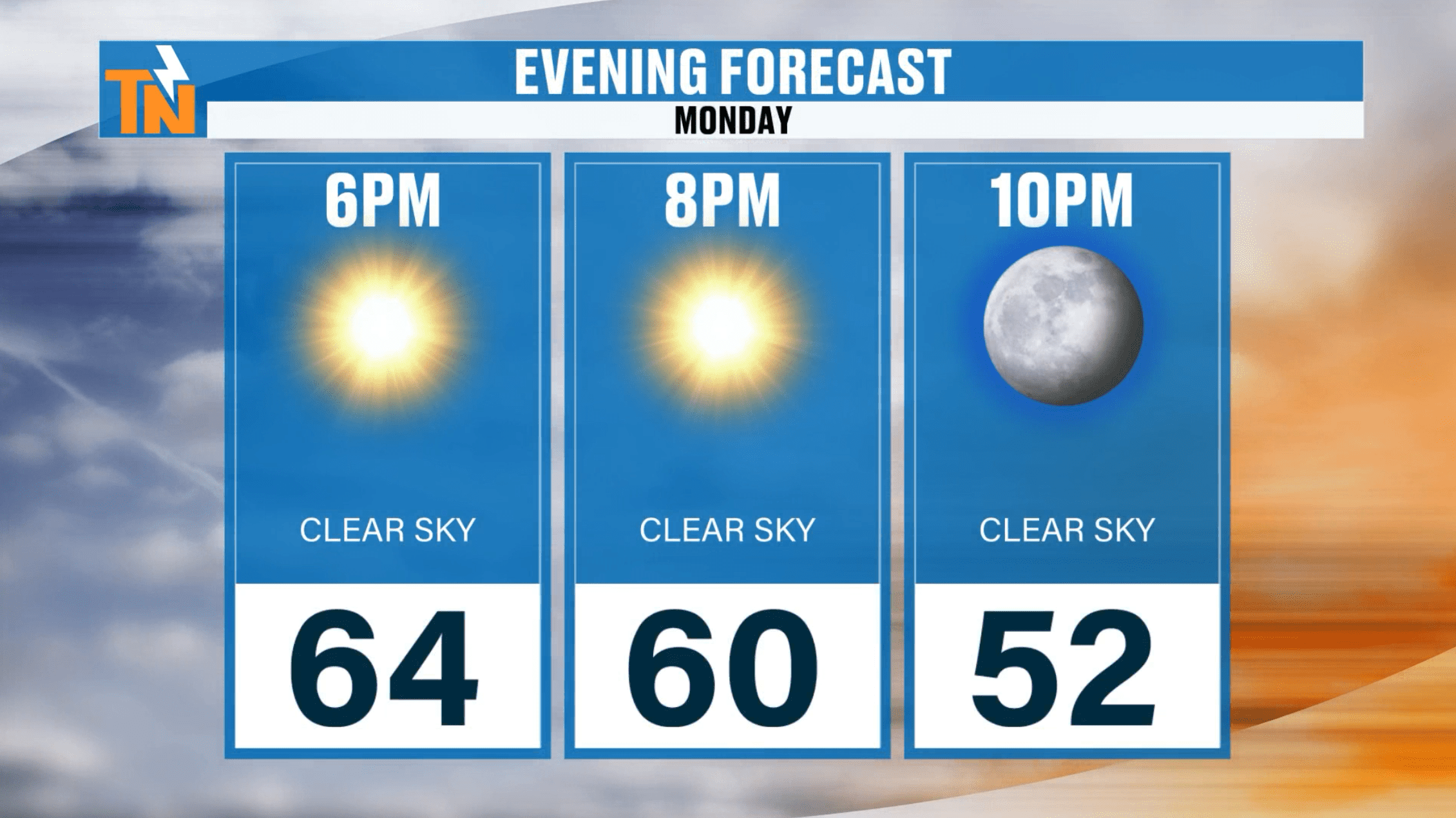
Another fabulous day around East Tennessee with abundant sunshine and slightly warmer weather. High pressure is the name of the game and with all that sinking air, high temperatures will reach the mid to upper 60s in most locations.
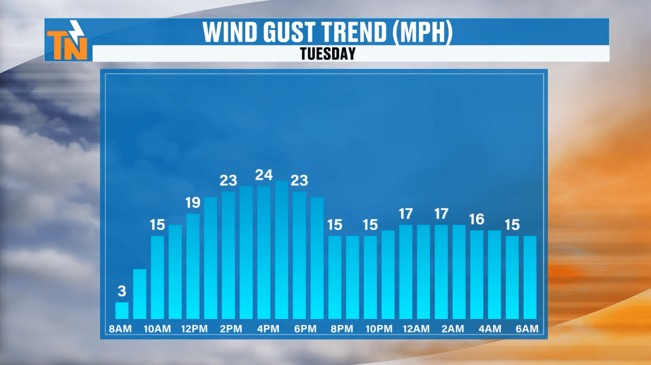
Our next cold front will be moving into the area on Wednesday. Out ahead of it, we’ll see increasing clouds on Tueday with a breezy southwesterly wind. Gusts can be anticipated to about 20-25 mph through the afternoon. We are dry on Tuesday, but jut some light rain will be moving in through about sunrise on Wednesday. This is a weakening cold front, so don’t expect a ton of rain. Through the day on Wednesday, the air will dry out and we’ll end the day with some sunshine.
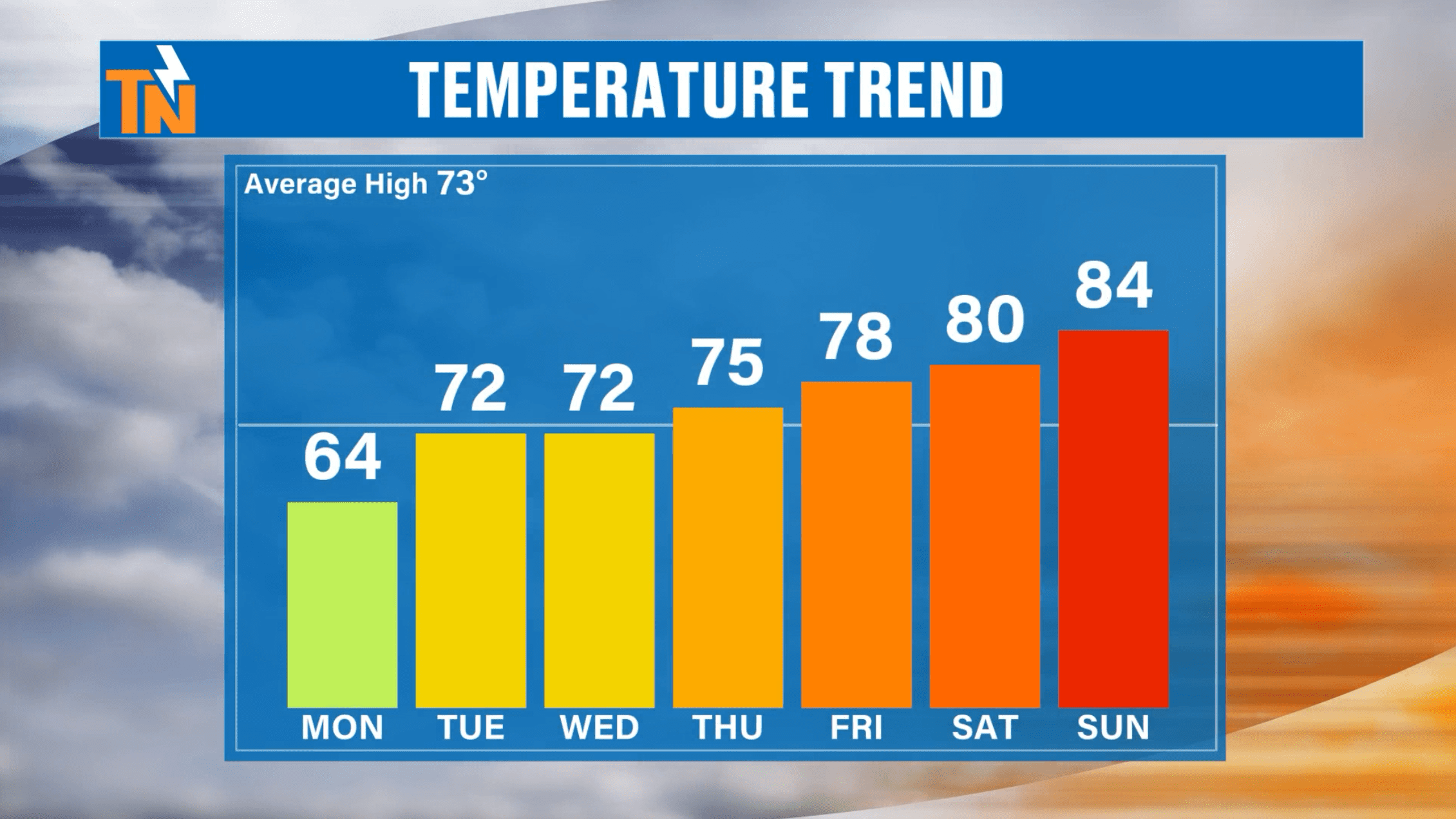
A ridge of high pressure with our jetstream will help to warm us up even moreso by the end of the week and into the weekend. We will be tracking another cold front on Friday into Saturday, but yet again, it doesn’t appear to bring us much in the way of rain. And again, we don’t cool behind this front as temperatures this weekend will be pushing 10 degrees above average for this time of the year.
